Overview
Basemaps and Map Layers allow you to view specific geographic information when adding a new location or viewing existing locations, either from the Location or within Outreach.
Basemaps
There are two basemap options: "Map" and "Imagery with Labels." To select a basemap, click the Basemap icon within the map.
Note: The image below shows the Location function. For Outreach, the basemap options are located in the lower-left corner.
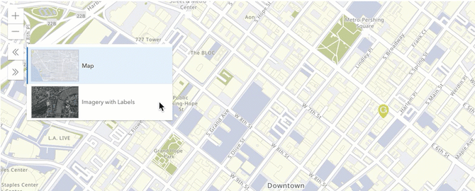
The "Imagery with Labels" basemap includes satellite and high-resolution aerial imagery and place names.
Map Layers
- If Outreach has been enabled, you can use the Data Filter to show/hide layers.
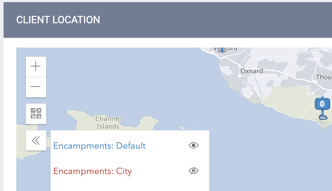
- When adding or viewing client locations within the LOCATION tab or when entering geolocations, you can click the Layer icon in the map to display the Layer pop-up, where you can select layers to show/hide.

Viewing the Continuum of Care (CoC) layer allows you to identify whether a location falls within the boundaries of the CoC. These boundaries are defined by the CoC GIS shapefiles, published by the Department of Housing and Urban Development (HUD) each year.

The Layer pop-up can also be used to show/hide Encampment Categories that have been enabled for the CoC in Outreach Settings. Each selected category will be displayed in its assigned color.
Updated: 02/05/2024